|
|
Post by Game Master on Oct 28, 2006 4:39:24 GMT -5
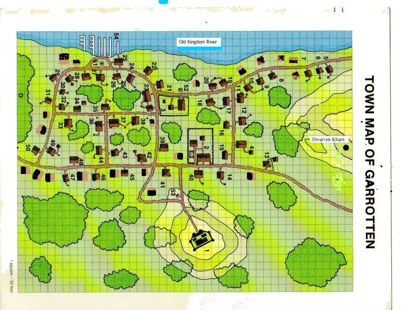
Here is the map of the Town of Garrotten and a key for it's points of interest. Please note that NORTH is up.  1. Garrotten Keep 2. The Travelers Inn 3. Tools of the Trade Armory and Smithy 4. 5. Monnhaven's Cabin 6. The Home of Aiko (Stone) and friends 7. Home of the D'encre Family 8. 9. 10. 11. 12. Lord Kursaville's Cabin 13. Gaurd and Toll house 14. Cutting Edge Jewelers (fence) 15. 16. 17. 18. 19. 20. 23. The Nexus Point: Alchamist shop 24. Madam Zantel's Fortunes 25. River Wardens Office/home 26. River Wharehouse 27. The Drunken Griffin Tavern 28. River Wharehouse 36. Thieves Guild 39. Constable Ritages Office 40. First Church of Garrotten 41. Town Hiring Hall 42. Jhessil's Trading Goods 45. Androsia's Herbs & Medicines 46. Guild Hall 47. Gaurd house 50. Warshack's Stables 51. Statue of the Lord of Light 52. Statue of Mistress Death 53. Statue of all three Deities 54. Boat Docks D. Druid Temple |
|
|
|
Post by Game Master on Nov 18, 2006 3:35:54 GMT -5
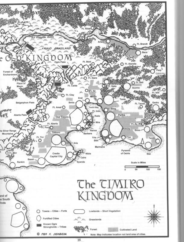
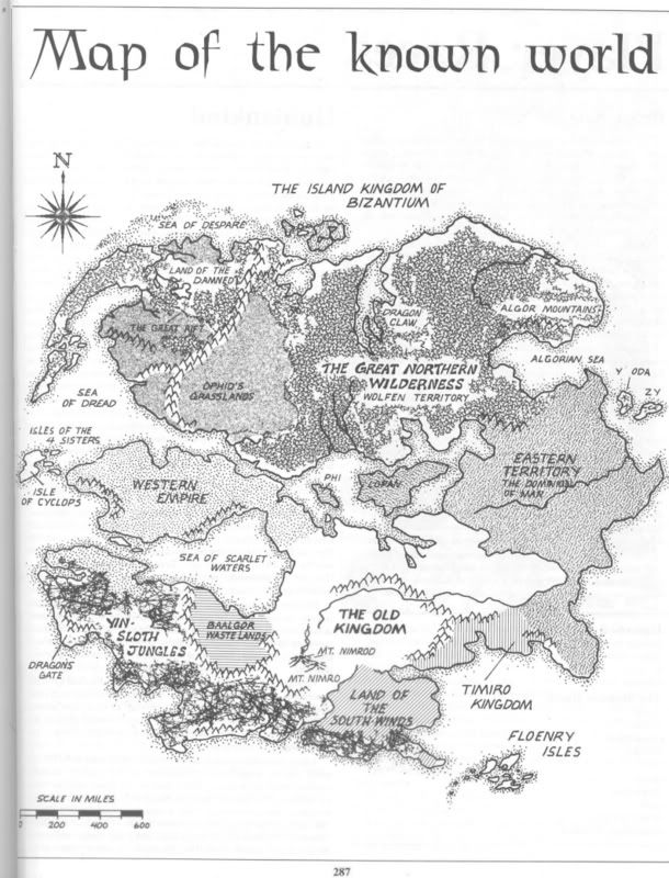
ok, to help orient yourselves I'll be posting a Kingdom of Timiro map on this thread as well as a World map.
As far as Garrotten goes here are a few notes.
Garrotten is a small town on the very outskirts of The Timiro Kingdom, taking the place of 'BACA' in the North East corner of the Timiro map. The Old Kingdom River runs right next to town. The river flows from the Old Kingdom Mountains in the West and travels down river to the East into the Eastern Territories. If one is traveling North (accross the river) one must hire a river boat or take the ferry 10 miles up river. The Ferry takes you directly to Fort Brandt. Further north is wild forest country.
The road out of Garrotten heading east (top of map) mianders through a forest area aprox. 150 miles in diameter at its thickest points. This road is 100 miles long and leads eventually to the SE to the next closest town called Parp (a small farming community).
The road leading west out of town (bottom of map) veers south quickly and leads through a small wooded area and farmland until it comes to Fort Alandia, some 75 miles SW of Garrotten.
if one were to go upriver one would come to the tiny town of Arian some 150 miles away and just over 80 miles inside the Old Kingdom border. As part of the Timiro Kingdoms expansion efforts into the Old Kingdom Arian is humanities farthest settlement in that direction. Most of the inhabitents are hunters and trappers and are in constant battle with inhuman raiding parties. The land besides the river between Arian and Garrotten has been heavily cultivated and dotted with fisherman and Farmsteads.
|
|
|
|
Post by Game Master on Nov 18, 2006 4:54:34 GMT -5
Here is the Map of the Timiro Kingdom. Most if not all of the adventures will take place within the boarders of this map.  |
|
|
|
Post by Game Master on Nov 18, 2006 14:11:58 GMT -5
Here is the world map. We are in the bottom right cornerish area.  |
|
|
|
Post by Game Master on Apr 30, 2009 2:03:25 GMT -5
well somehow I deleted the Garrotten map from Photobucket. DAMN! I have no scanner so no way to repost it right now. I'll have to try and take a picture of it. It won't be a good though.  |
|
|
|
Post by Game Master on Jan 15, 2010 1:06:42 GMT -5
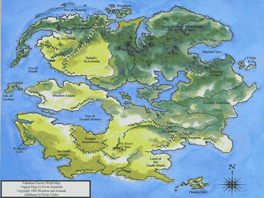
Here is another world map, but in color.  |
|